The Doughnut, the River, and King Cunobeline’s gold mines
An eulogy of sorts to the river Mardyke in the English county of Essex, and a brief rumination on whether horses experience jealousy
On the banks of the River Thames in Essex, not far from London, the M25 motorway and the A13 trunkroad cross paths. For those unfamiliar with these roads, the 117 mile-long M25 encircles London; an asphalt girdle whose poet laureate is the writer Iain Sinclair. The A13 meanwhile, runs 41 miles from London to the Essex seaside town of Southend-on-Sea. Its cultural representative is the Bard of Barking, Billy Bragg.
The M25-A13 junction is a busy interchange, thanks to its close proximity to both the Dartford Crossing, the bridge-tunnel combo that passes over and under the Thames, and the sprawling Lakeside retail hellscape. It is a brutal topography, dominated by heavy goods vehicles, with bleak views of the heavy industry and distribution centre sheds that cluster around the banks of the river.
The sodden Mardyke Way was unwritten, forlorn. Eco-bureaucrats smeared it with their feelgood fictions: ‘A secret landscape of classically flat flood plains bounded by ancient woodland on all sides.’ Which interprets as: pylons, irrigation ditches, scrub, damp cattle. Bounded by the ‘ancient’ Purfleet Arterial Road and the ‘classically flat’ M25, this country was so sad that nobody had the heart to exploit it.
Iain Sinclair, London Orbital
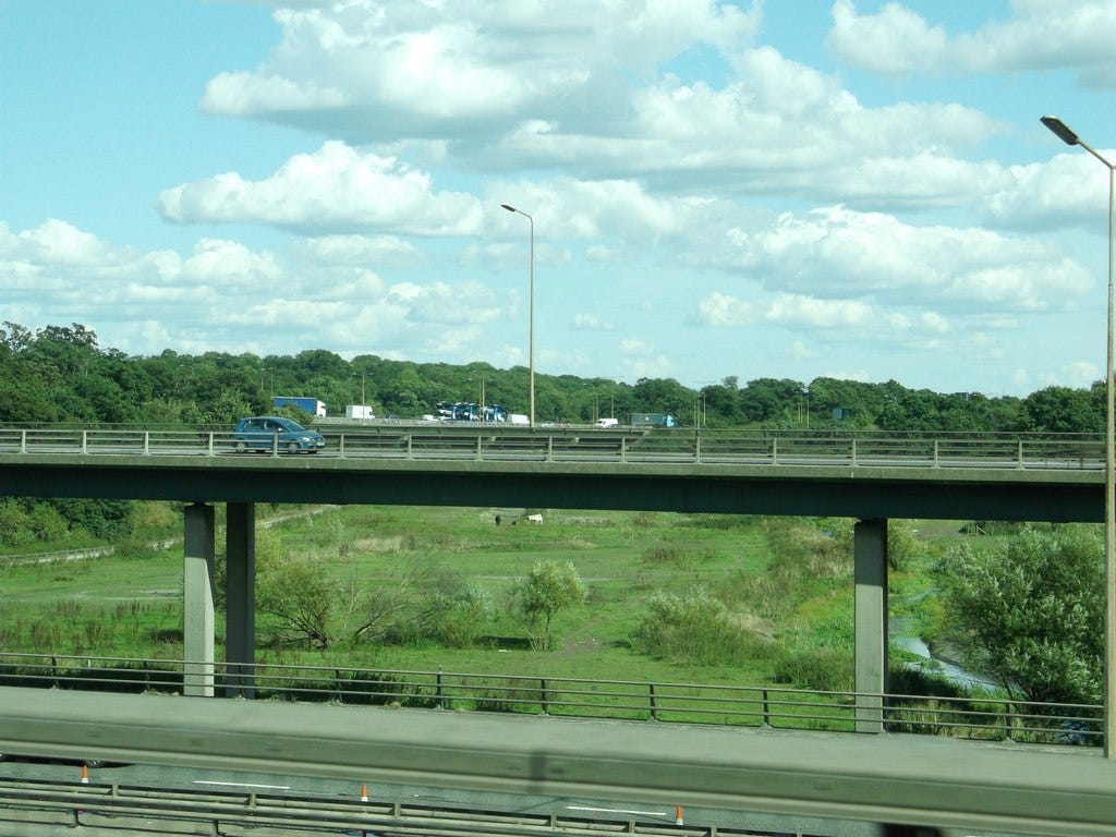
The M25 and A13 meet on a sweeping ring of tarmac that I remember being referred to as the doughnut when I was a child. Technically the doughnut was a roundabout, but it was a large one, and I have vivid memories from my childhood of sitting in the back of my Dad’s Ford Cortina as we moved at speed around the doughnut’s curves. You had to drive fast on the doughnut, so as to slot in with the flow of traffic. Sometimes it felt as though we were on a speedway circuit, its centrifugal forces pulling us outwards, squashing our faces against cold rear windows for comic effect.
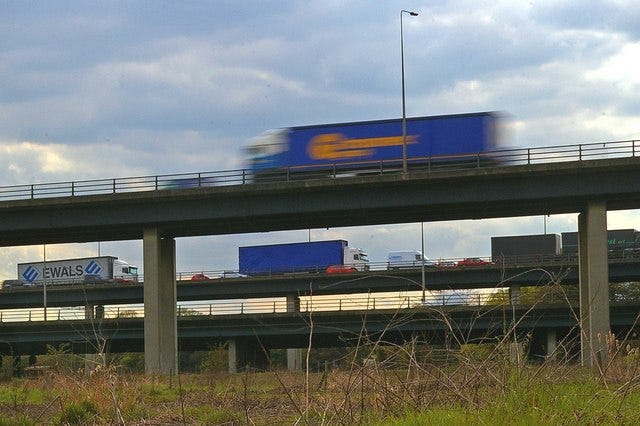
The M25-A13 intersection resembles a pile of asphalt spaghetti: a confusion of elevated roadways, roundabouts and slip roads which encircle or pass over and underneath each other. This entanglement isn’t part of the landscape, but is thrusted above it, on a forest of thick concrete pillars. The landscape underneath could be described as dystopian bucolic; a mix of boggy pasture, scrub and woodland, persevering under a permanent petrol fug. There is a small river threading through it, barely a stream really, meandering its way towards the Thames. It is from this river that the junction above takes its official name as the Mar Dyke Interchange.
The name Mar Dyke, or Mardyke, has an extra personal dimension of meaning for me. It was the name of my house at the junior school I attended in Rainham, just a few miles away from the doughnut, between the years 1982 and 1985. Our four house teams were named after four local rivers, our local landscape being, after all, an estuarine one, where the shoreline separating the river from the Essex marshes was indistinct at best. The four rivers in question were the Roding, the Ingrebourne, the Mardyke, and the Beam. Four decades later they still conjure up the names of school friends and bullies that I haven’t seen nor heard from since finishing junior school. They also conjure up colours—red, yellow, green and blue respectively—and the charts that we had in each classroom to keep a tally of each teams’ points. They remind me of my lifelong proclivity for the colour green, the colour of Mardyke, and I can remember as well the rising and falling fortunes of each team; how one year the colour blue (Beam) might be associated with prowess on the sports field, or how yellow (Ingrebourne) might be artistically inclined.
And yet, in spite of how ingrained the names of these four rivers were into our day-to-day school lives, I don’t know that we were ever taught about where these rivers started, where they finished, and what lay in between the two. In fact, it wasn’t until many years later that I made the connection between my house team and the small stream that threaded its way between the concrete pillars of the M25-A13 interchange. A sad reflection, I suppose, of the gap that existed even then between the constructed landscape in which we lived our lives, and the natural landscape that lay underneath it all. Living in 1980s suburban Essex, nature was mostly something you saw out of the car window, and the closest you ever usually got to it was when you walked the family dog along the grass verges of your local streets.
Why such a disconnect? Why did I not know the whereabouts of these rivers? Because the Mardyke, like so many other small rivers that trace watery lines across the landscape, doesn’t really serve much of a purpose any more, beyond being a green corridor and a haven for nature (functions which I think many of us would argue are actually quite important).
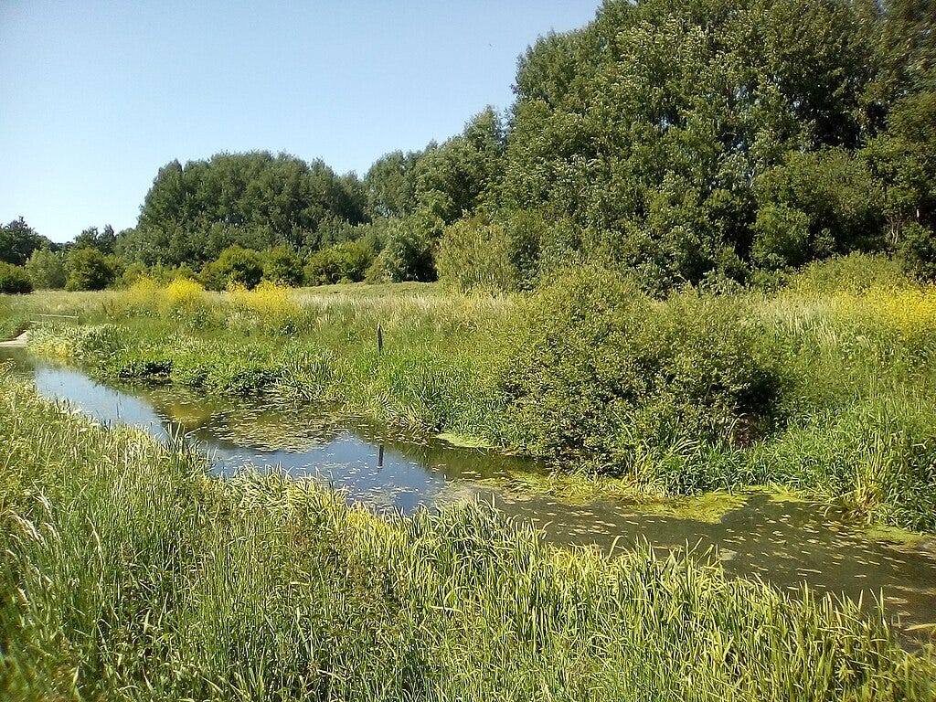
But in the pre-modern era, before the roads and interchanges and retail sheds and distribution hubs, the Mardyke was an important part of the south Essex fenlands. From its source in the woods around the village of Great Warley, to its mouth, eleven miles away, at Purfleet where it feeds into the Thames, the Mardyke served a number of important functions.
For a start its meandering route served as a boundary, the name Mardyke being derived from the Anglo-Saxon name for a boundary ditch. Along part of its course the Mardyke serves as a boundary between the Essex hundreds of Barstable and Chafford, a hundred being an administrative unit that the Anglo-Saxons used in this part of the world. The Mardyke’s course still has some contemporary relevance to borders and boundaries, in that it vaguely follows the administrative boundary line separating Havering, London’s easternmost borough, and Essex. If you look on Google Maps you can find the easternmost point of London marked on the river’s banks at 51.5406116986818, 0.3344780720128434.
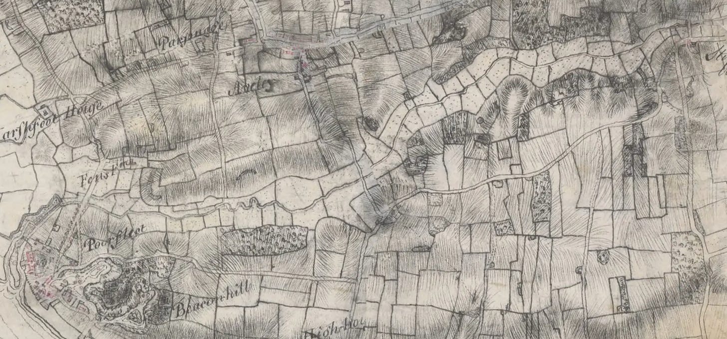
The Mardyke was also an important means of communication in the pre-modern era, at a time when the waterlogged marshlands made roads unfeasible. Farmers transported their goods and raw materials along the river, which was part of a wider network of irrigation channels and drainage ditches that were tidal up until the 1760s, when ambitious plans were drawn up to convert the full length of the river into a canal, with five locks to accommodate its fifty foot rise. These plans did not come to pass, although the British government did agree to canalise the lower section of the river in the 1760s, in response to the relocation of the royal gunpowder stores from Woolwich to the mouth of the Mardyke at Purfleet where, in the fourteenth century, the Knights Templar had onced owned a watermill.1
Along the length of the river, archaeologists have found evidence of human activity stretching back to the neolithic period. Stone flints and an axe head, a hammerstone, the bronze blades of daggers and swords, Roman bottles and cups, a pilgrim’s badge.2 In the late nineteenth-century archaeologists explored numerous deneholes along the river: excavated pits dug to extract chalk for lime-burning from underneath the clay. The deneholes, which were dug in pre-Roman times, consist of vertical shafts leading to artificial chambers, and have been found on their own or in groups of two or three along the river’s course.3 William Camden described the deneholes in the early seventeenth century, and his description suggests that they had long been thought of as the treasure troves of a first-century British king.
Neer untoe Tilbury, there be certaine holes in the rising of the chalkey hills sunke intoe the ground tenne fathom deepe, the mouth wherof is but narrow, made of stone cunningly wrought, but within they are large and spacious. Tradition hath it that they be some of King Conubelin’s golde mines.
William Camden, Britannia, 1610
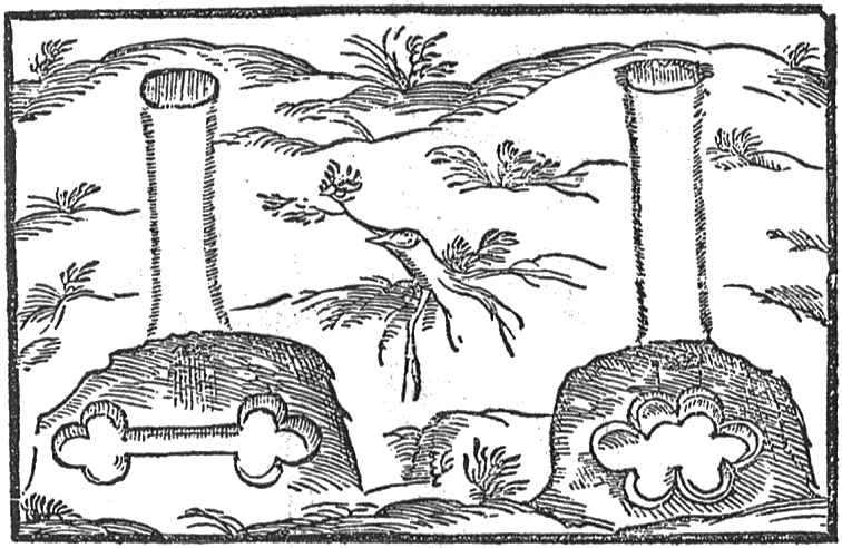
The area’s subsequent Roman inhabitants repurposed some of the deneholes as burial chambers for their dead. To think then, for those that lived in this corner of Essex throughout human history, the Mardyke was their world, dictating how they lived, worked, and died.
On the rare occasions when I visit Essex nowadays, it is often via the Dartford Crossing from Kent, and I always make a point of looking down on the meandering banks of the Mardyke below as I cross on the M25 above.
As a child and as an adult now, I often saw and occasionally still see horses grazing on the grassy banks of the river below. And whenever I have seen them it has provoked a sense of melancholy in me. How did those horses get there, I think to myself, and to whom do they belong to? At ground level they might be grazing in a seemingly bucolic landscape, but it is a landscape that survives in spite of the concrete roadways and traffic fumes above. I don’t suppose the horses mind grazing there, underneath all that noise and pollution, and I don’t imagine that they spend much of their time dwelling on the injustice of other, luckier horses having much nicer places to graze elsewhere. So perhaps I should be more optimistic. In recent years the Mardyke has become an important green space in this part of Essex. It is now looked after, protected, and enjoyed by residents and nature lovers, and those horses are an important element of this conservation work.4 They are a continuation of a pre-modern practice, an enduring connection between the Mardyke of the past and the Mardyke of the present.
Andy Wood, Abandoned and Vanished Canals of England, Amberley Publishing, 2014.
Proceedings of the Society of Antiquaries of London, Second Series, Vol. III, London: The Society of Antiquaries, Thursday, January 10th, 1867.
Transactions of the Essex Field Club, Vol. III, Part 7, June 1883; “Proposed exploration of the Essex Deneholes” The Essex Notebook and Suffolk Gleaner: A monthly Repository of Curiosities, November 1884.
Thurrock Council, “Mardyke Valley” https://www.thurrock.gov.uk/mardyke-valley/wildlife [accessed 20/01/2025]


